I-8 trunk relocation near 16th Street interchange
ADOT MOT and night drilling windows — permit lead exceeds bore duration; alignment engineered before bid.
Yuma, AZ · Yuma County
Yuma highway, canal, and Colorado River crossings on I-8, US-95, and irrigation easements — long-span HDD and casing when open cut fails ADOT, district, and flood-control review.
River, highway, and canal crossings in Yuma are where trenchless stops being optional — ADOT relocations on I-8 and US-95, irrigation canal paths, and Colorado River floodway alignments rarely justify open cut against engineered bore plans.
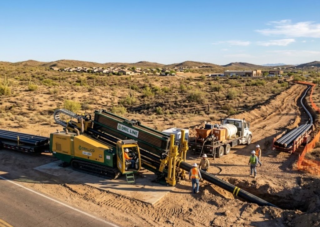
Directional boring in Yuma at crossing scale means larger spreads, staged reaming, pullback monitoring, and agency calendars that start months before drill day. Traffic control, night MOT, and harvest-season truck windows set the schedule more often than rig availability.
Municipal water and sewer trunks, telecom backbones, and cold-storage electric feeders share corridor headaches — multiple utilities in one casing require engineered dividers and maintenance access, not ad hoc bundling.
Real Yuma County angles — not generic statewide copy.
ADOT MOT and night drilling windows — permit lead exceeds bore duration; alignment engineered before bid.
District and bank stability review — HDD or jack-and-bore profile avoids open cut through easement fill.
Flood-control and levee review — engineered profile avoids open cut through river alluvium and trail systems.
ADOT permits and franchise alignment — long shot with staged ream and survey closeout.
Yuma crossing work begins with engineered profile and controlling permit identification — ADOT, irrigation district, or flood authority leads notification beyond standard 811. Larger rigs mobilize with mud plants, dewatering, and pullback monitoring; inspection milestones follow agency documents. As-built survey delivers before final restoration.
Yuma soils are Colorado River alluvium, running sand, and compacted agricultural fill — high water table near the river and canal banks demands dewatering discipline absent on Phoenix caliche jobs.
Most Yuma bores hit loose Colorado River sand and silt in the first few feet, then compacted agricultural grading or foothill caliche depending on parcel elevation. River-adjacent and canal-bank shots carry high groundwater that collapses uncased entry pits without dewatering. Fortuna Foothills master-plan fill can hide old field drainage tiles that potholing catches before pits are sized. We size ream stages for Yuma alluvium and water table, not a Phoenix caliche template.
Yuma's low-desert heat and summer monsoon surges shape bore schedules — Colorado River humidity pockets and afternoon lightning holds are planned into quotes.
Monsoon season from July through September raises groundwater near the Colorado River and can delay entry pits on canal-adjacent parcels. Winter harvest season stacks truck traffic on Avenue 9E and I-8 frontage — bore schedules account for cold-storage peak windows. Summer heat above 115°F slows afternoon startup on exposed sites but rarely stops work — we communicate when dry sand conditions matter for long pulls rather than risk frac-outs toward irrigation laterals.
City of Yuma Development Services, Yuma County ROW, ADOT District 11, irrigation district easements, and MCAS Yuma coordination apply on many alignments.
Inside Yuma city limits, street cuts, driveway removals, and canal-adjacent work may need Development Services permits. Yuma County ROW rules apply on unincorporated pockets toward the proving ground and Somerton fringe. ADOT controls I-8, US-95, and state highway bores — expect traffic control plans and sometimes night-only windows on harvest-season truck corridors. Irrigation district easements add coordination beyond standard 811. Military-adjacent parcels may add base and security review on pit placement.
Major Yuma crossings rarely justify open cut — detour cost, canal and floodway impact, and lane closure math favor trenchless once alignment is approved. Short local street bores are a different scope than mile-class highway crossings.
Length, diameter, groundwater, environmental windows, flagging, engineering, inspection.
You share plans or describe the problem; we confirm alignment, depth, access, and which trenchless method fits Arizona soils.
Arizona 811 ticket filed; two business days minimum before pits open unless your permit path differs. We pothole where marks conflict.
Bore plan, ADOT or city ROW permits, railroad agreements, and crossing engineering when the path leaves private property.
Compact spread for tight Scottsdale lots; larger HDD for I-17 or Loop 101 relocations — matched to length and diameter.
Steered pilot on design line, ream passes sized for your pipe or casing, fluid program tuned for caliche or decomposed granite.
HDPE fusion, steel casing, or multi-duct bundle pulled with tension and bend-radius monitoring.
Pressure test, mandrel, or survey records for owners, inspectors, and operators as spec requires.
Compact pits, replace gravel or hardscape per scope, leave 811 ticket and locate map in your project file.
District and scope drive weeks-to-months — assume permits before drill date, not parallel to mobilization.
Possible with engineered dividers and maintenance access per owner spec — not improvised bundling.
Colorado River floodway, local irrigation canals, and desert drainage each carry different easement and access rules.
Yes — district templates with inspection and restoration standards; irrigation agreements often set the critical path.
Length, diameter, groundwater, MOT, harvest windows, and inspection drive price — engineered quotes only.
24/7 — Emergency dispatch statewide. Tell us entry, exit, pipe size, and county — a bore specialist calls back with cost drivers, not a flat rate.
Scope your alignment
Step 1 of 2 — path, pipe, and city first